Showing posts with label Explorers. Show all posts

Wednesday, 5 October 2011

Byron, Wallis, Carteret and Philatelic Licence

John Byron by Joshua Reynolds, 1759, National Maritime Museum Greenwich

Byron and Dolphin June 1764 to May 1766
On the 21st June 1764 Commodore John Byron sailed HMS Dolphin from the Downs, sent by the British Admiralty, who had been persuaded by George III, to search for the great southern continent, believed to lie in the South Pacific.  With Dolphin were HMS Tamar captained by Patrick Mouat and the supply ship Florida.
Byron was accompanied on Dolphin by midshipman Charles Clerke later to sail on all three of Cook’s voyages and, following Cook’s death in 1779, took over command of Resolution.  Also sailing with Byron was master's mate John Gore who would sail on Dolphin’s second circumnavigation and on Cook’s first and third voyages.  When Clerke died (on his thirty-eighth birthday) from tuberculosis en route to Kamchatka in August 1779 Gore commanded the Resolution and Discovery expedition back to England.  Starting out on the Tamar before being promoted to First Lieutenant on the Dolphin was Philip Carteret, of whom more later.
Late 1764 and early 1765 were spent surveying Patagonia, the Straits of Magellan and the Falkland Islands., from where Florida returned to England with a message recommending that the islands be colonised.  This was nearly the cause of war between Great Britain and Spain, both countries having armed fleets ready to contest the sovereignty of the barren islands.
Byron had previously been in the area as a midshipman on HMS Wager, part of George Anson’s ill-fated 1740 to1744 expedition.  In May 1741 Wager was wrecked on the coast of Patagonia and it wasn’t until February 1746 that he was able to return to England.
Getting through the Straits of Magellan and into the Pacific took six frustrating weeks and by the time the ships came to what is now French Polynesia, the crew were suffering quite badly from scurvy, and this had a major influence on the conduct of the voyage through the Pacific.  They were desperate to restock with fresh supplies, in particular coconuts and fresh vegetables for the sick.  However, the local inhabitants opposed any landings with shows of arms, and coupled with the difficulty of anchoring near to the coral atolls, prompted Byron to name the first of them the Islands of Disappointment.  The ships went on to the Cook Islands, the Gilbert Islands and the Marianas, before heading back to Britain via the Philippines, Batavia, the Cape of Good Hope and St. Helena, which they passed on Sunday March 16th 1766 without stopping.


On April 1st after sustaining damage to her rudder, Tamar was diverted to Antigua to be fitted with a new one.  One of Byron's last official acts before entering port was to confiscate the journals kept by his crew members, a matter of routine on Navy voyages that was intended to guard against security leaks and guarantee that only the official, government-sanctioned version of the voyage would reach the public. Dolphin reached the Downs on the 9th May, Tamar a month later, the journey having taken just over 22 months which at the time was the fastest ever circumnavigation of the globe, but the discoveries made were very limited and the Admiralty made rapid plans to send the Dolphin back to the Pacific.


Samuel Wallis by Henry Stubble, ca 1785, National Library of Australia


Wallis and Dolphin August 1766 to May 1768
Losing no time, on the 19th August the Admiralty recalled Captain Samuel Wallis to active service and gave him sailing orders to take HMS Dolphin back to the Pacific for a second expedition.  Accompanying him was HMS Swallow under the command of Philip Carteret, (who had only been back in England three months), and the store-ship Prince Frederick.  Wallis kept his orders secret from Carteret until they were three weeks out at sea. Carteret thought that the fleet was going to re-provision the settlement at Port Egmont in the Falkland Islands but the real objective of the fleet was to sail for Magellan Straits where the Prince Frederick would head back to the Falklands and the Dolphin and the Swallow were to sail west for further exploration in the Pacific.  After struggling through the Magellan Straits for 115 days, they reached the Pacific Ocean where on 11th April 1767 the Swallow, in no fit state to undertake the journey in the first place, was separated from the Dolphin.  On 23rd June Dolphin arrived at Tahiti and Wallis sent Tobias Furneaux, the second lieutenant, ashore to claim it for England naming it King George Island.  Furneaux would return to Tahiti in 1773 as Captain of Adventure accompanying Resolution on Cook's second voyage.
Wallis and his crew had communication and cultural difficulties and sailed from Tahiti on 27th July after having refitted the Dolphin and loaded up with water and fresh food.  They sailed to the islands to the west of Samoa that now bear his name, to Tinian and on to Batavia where Wallis lost forty men to smallpox and most of his crew were unfit for duty on the crossing of the Indian Ocean to the Cape of Good Hope. 

 The Dolphin had to spend a month in South Africa so that the crew could recover their health. On the 17th March 1768 Dolphin arrived at Jamestown but left at noon the following day.
“At six o’ clock in the evening of Wednesday the 16th we saw the Island of St. Helena, at the distance of about four leagues and at one the next morning brought to.  At break of day we made sail for the island and at nine anchored in the bay.  The fort saluted us with thirteen guns and we returned the same number.  We found riding here the Northumberland Indiaman, Captain Milford, who saluted us with eleven guns and we returned nine.  We got out all the boats as soon as possible and sent the empty casks to be filled with water; at the same time several of the people were employed to gather purslain (purslane) which grows here in great plenty.  About two o’ clock I went on shore myself and was saluted by the fort with thirteen guns, which I returned. The Governor and the principal gentlemen of the island did me the honour to meet me at the water-side, and having conducted me to the fort, told me, that it was expected that I should make it my home during my stay.  By noon the next day our water was completed and the ship was made ready for sea; soon after she was unmoored to take advantage of the first breeze, and at five in the afternoon I returned on board.  Upon my leaving the shore I was saluted with thirteen guns, and soon after upon getting under way I was saluted with thirteen more, both of which I returned; the Northumberland Indiaman then saluted me with thirteen guns, so did the Ollery, which arrived her the evening before I made sail, and I returned the compliment with the same number.”

St Helena, Jamestown, Dolphin Postal Stone 1645
The postal stone outside the Castle in Jamestown refers to a much earlier ship.  Dolphin finally reached England on the 18th May 1768 after a twenty-one month circumnavigation becoming the first ship to sail twice around the world.  It was presumed by Wallis that the Swallow had been lost; it was reported as such when they reached Britain and James Cook believed this to be the case when he left Plymouth for Tahiti in the Endeavour with Joseph Banks in August of that year. 
Why Tahiti?  Dr Nevil Maskelyne, Astronomer Royal and fellow of the Royal Society, had calculated that the best possible vantage point south of the equator to observe the 1769 Transit of Venus was between the Marquesas Islands and Tonga.  The preferred site within this large area had not yet been determined when Wallis returned to England having “discovered” Tahiti, located almost at the centre of the area identified by Maskelyne.  Tahiti’s longitude had been established by the Dolphin’s purser, John Harrison, (not the John Harrison of Longitude fame) using Maskelyne’s astronomical tables to perform the mathematically complicated but effective method of calculating lunar distances.  Thus it was that the Royal Society informed the Admiralty that Tahiti was its desired site for the Pacific observation of the transit, and Cook set sail accompanied by John Gore who knew more about the Pacific than anyone else on the ship and three other Dolphin seamen, Molyneaux, Pickersgill and Wilkinson.

Philip Carteret
Carteret and Swallow April 1767 to March 1769
But Swallow was not lost, just abandoned and Carteret felt bitter and angry about having been left with a slug of a ship and an inadequate crew.  He sailed for Juan Fernandez Island intending to refit but it was occupied by Spanish colonists and he was forced to sail to the island of Mas Afuera where there was no safe anchorage and they had trouble getting water.  (Mas Afuera is one of a group of islands about 600km from the coast of Chile and, since they are mainly known for having been the home to the sailor Alexander Selkirk for four years, which may have inspired the novel Robinson Crusoe, have been renamed Alejandro Selkirk Island, Santa Clara Island and Robinson Crusoe Island).  They left on the 31st May with only half a supply of food and water and sailed north in order to pick up the trade winds to get them across the Pacific.
Sailing west just south of the tropics Carteret describes in his log the discovery for which this expedition is best remembered:


“We continued our course westward till the evening of Thursday the 2nd of July, when we discovered land to the northward of us.  Upon approaching it the next day, it appeared like a great rock rising out of the sea.  It was not more than five miles in circumference, and seemed to be uninhabited.  It was however covered with trees, and we saw a small stream of fresh water running down one side of it.  I would have landed upon it, but the surf, which at this season broke upon it with great violence, rendered it impossible.  I got soundings on the west side of it, at somewhat less than a mile from shore, in twenty five fathoms, with a bottom of coral and sand, and it is probable that in fine summer weather, landing here may not only be practicable, but very easy.  We saw a great number of sea birds hovering about it, at somewhat less than a mile from the shore, and the sea here seemed to have fish.  It lies in latitude 25°, 2′ south, longitude 133°, 21′ west, and about a thousand leagues to the westward of the continent of America.  It is so high that we saw it at the distance of more than fifteen leagues; and it having been discovered by a young gentleman, son to Major Pitcairn of the marines, who was unfortunately lost in the Aurora, we called it PITCAIRN'S ISLAND."
Carteret, sailing without a chronometer was unable to precisely determine longitude so his recorded position of 133.21 W placed Pitcairn over 200 miles from its true position of 130.06 W.  That twenty-three years later Pitcairn was able to provide a refuge for the mutineers from HMS Bounty, not finally being discovered until 1808 is undoubtedly due in part to the fact that nobody in the Royal Navy knew precisely where the island was.  The error was also compounded in the first edition of Hawkesworth where the latitude in the text disagreed with the map position by an additional 350 miles.  Following the Mutiny on April 28th 1789 Fletcher Christian not only took over Bligh's cabin but his library.  Thus the mutineers of the Bounty were able to seek Pitcairn Island as their refuge in January 1790 because they had on board Hawkesworth's volumes and read therein the report of Carteret's discovery in 1767.  That they found the island despite the errors is remarkable but of such errors are legends born.
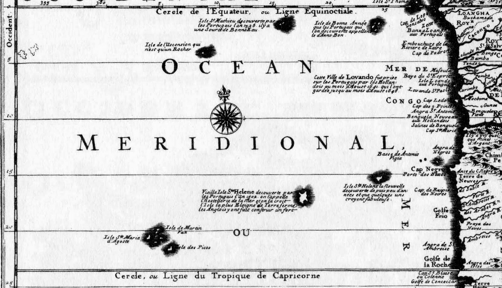
Carteret turned north and sailed west of the Society Islands and east of Samoa.  At about 10 00 S 167.00 W Dolphin veered to the west, looking for the Solomon Islands. He found Santa Cruz, but had to sail away without all the supplies they needed.  Leaving New Ireland on 9th September 1767 they made for Mindanao in the southern Philippines where the natives fired guns to signal them not to land so Carteret moved on and sailed between Sulawesi and Borneo to Batavia where the Swallow was repaired and re-provisioned for the voyage home.  Carteret could not wait to get away from Batavia because of the sickness and left on 15th September with many of his crew sick with malaria or dysentery.  The Swallow took two months to cross the Indian Ocean to Cape Town.  Leaving in the new year of 1769, from the 20th to 24th January they were at St Helena some ten months after Wallis. 

Following closely behind Carteret, passing St. Helena on 29th January, was Bougainville in the Boudeuse returning to France from his own 1766 to 1769 circumnavigation. 

 Bougainville had received news of Carteret at Batavia and at the Cape and reaching the (then) uninhabited Ascension on the 4th February he read a note left in a bottle informing him that the Swallow had departed on 1st February.  After collecting turtles, as Carteret had done, on the 19th February Swallow was sighted and Bougainville offered Carteret assistance, which was politely declined.  Bougainville described Swallow as being in poor condition and wondered how it had sailed so far and how miserable it must have been on the ship.  In any event Carteret finally arrived back in England on 20th March.
Which brings us to the philatelic licence of Swallow and Dolphin together at St Helena.


Tuesday, 23 August 2011

St. Matthew Island and two St. Helenas

1519, St. Helena, Atlas Nautique du Monde, Biblioteheque National de France
The genesis of this post was the page in the Maps and Views section of Barry Weaver’s St Helena Virtual Library and Archive illustrated by a part of Jansson’s 1646 map “Mar di Æthiopia Vulgo Oceanus Æthiopicus which describes the appearance, on early maps, of the mythical islands of New St. Helena and St. Matthew.  It can be accessed here: http://www.bweaver.nom.sh/maps/jansson.htm 

As he suggests: “the mislocation of islands was inevitable given the large navigational errors common in the sixteenth and seventeenth centuries, but once added to sea charts such islands proved extremely resilient, even in spite of a lack of any further evidence to support their existence.”

1547,Vallard Atlas, St. Matthew and St. Helena, South Orientation
Click on images to enlarge

1554, Gastaldi, St. Matthew and St. Helena, South Orientation

1570, Ortelius, St. Matthew

1596, Linschoten, St. Matthew and St. Helena

In 1656 Peter Mundy refers to St Matthew Island when writing about Ascension:
Soe now againe concerning the Ascention birds allsoe, thatt can neither fly nor swymme.  The iland beeing aboutt 300 leagues from the coast of Guinnea and 160 leagues from the iland of St Matheo, the nearest land to it, the question is, how they shold bee generated, whither created there from the beginning, or thatt the earth produceth them of its owne accord, as mice, serpentts, flies, wormes, etts, insects, or whither the nature of the earth and climate have alltred the shape and nature of some other foule into this, I leave it to the learned to dispute of.

By 1634, in addition to St. Matthew, a second St. Helena started to appear on Maps and Charts.

1634, Guerard, Carte Universelle Hydrographique, Biblioteque National de France


1664, Du Val, I Ste Helene la nouvelle

1689, Coronelli

Though admitting that the New Isle of St Helena was thought by many to be legendary, St. Matthew is described as having a small lake of good fresh water and that it was discovered in 1526.

1706, Schenck

1717, Nicholas de Fer

1722, Nicholas de Fer
De Fer repeats the same information about St. Matthew as the 1689 Coronelli map

On his second voyage Cook sailed on “Resolution” from St. Helena on the 21st May 1775.  On the 31st May he left Ascension and “steered to the northward with a fine gale at S. E. by E.”  “I had a great desire to visit the island of St. Matthew, to settle its situation; but as I found the wind would not let me fetch it, I steered for the island of Fernando de Noronha, on the coast of Brazil in order to determine its longitude, as I could not find this had yet been done.  Carrying on board Kendall’s KI chronometer "Resolution" was the first survey ship to carry such an instrument and had St Matthew existed would have been charted with some accuracy.

Purdy's 1814 "Tables of the observed positions of the principal points and places on the coasts of the Atlantic, Ethiopic and Indian Oceans" casts doubt on the existence of St. Matthew:

"We are told, by several historic geographers, that St. Matthew is an island discovered by the Portuguese, in the year 1516, by whom it was afterwards planted; and that vessels frequently stop here some days to take in refreshments.  Guthrie says (Edition of 1783) the Portuguese " planted and kept possession of it for some time; but afterwards deserted it.  This island now remains uninhabited, having little to invite other nations to settle there, except a small lake of fresh water."

"We think it not improbable that this island, like the Land of Bus, in the Northern Ocean, may have entirely disappeared.  Archihald Dalzel, Governor of Cape Coast Castle, sought for it, without success, in 1799 and 1802, and it appears almost certain, from his routes, between 1 and 2 degrees South, longitude, 3 to 10° W. that it does not exist within this space.  "Mr. Dalzel has made many enquiries among the Portuguese about this island, without meeting with any person who pretended to have seen it, except one, who gave him a rough draught of it, which was laughed at by the other Brasilians, who said he must have been deceived by a cloud."

It did, however, still appear on the 1828 German map below.


Monday, 6 June 2011

Cook, Hawkesworth and Wheelbarrows, 1775


The most Striking Likeness of the late Captain James Cook.
From A new, genuine and complete history of the whole of Capt. Cook's Voyages.
London 1790.

James Cook’s first voyage between 1768 and 1771 was a collaboration between the British Admiralty and The Royal Society to send an expedition to the South Pacific aboard the renamed and refitted ex-Whitby Collier HMS Endeavour.  The aims of the expedition were to observe the 1769 Transit of Venus across the sun and, given sealed and secret orders so that Cook did not know his ultimate objective until well into the voyage, to seek evidence of the postulated Terra Australis Incognito or “unknown Southern land”.  Sailing with Cook were the naturalist Daniel Solander and the wealthy amateur botanist and Fellow of the Royal Society Joseph Banks.  The three year voyage achieved much, the identification of Botany Bay, (first named Stingray Bay, later Botanists' Harbour and Botanists’ Bay, and finally Botany Bay in his journal, probably to honour the botanists aboard), taking possession of the east coast of Australia, mapping the coasts of New Zealand and defining the shape of the southern hemisphere. Returning home to England Endeavour stopped, from the 1st to 4th May 1771, at St. Helena.

On the 12th July 1771 Cook wrote to the Commissioners of His Majesty’s Navy from Endeavour in the Downs formally passing the records of the voyage, in seven parcels of documents, to the Commissioners.  These included the monthly muster books, reports of surveys and the public papers of five men who died on the voyage.  Log books and other papers from the voyage had been given to HMS Portland off Ascension on May 10th and had arrived in England three days before Endeavour.

The Admiralty at this time did not publish official accounts of the expeditions it financed, relying on the private sector to do so.  Following a process that relied upon a mix of author capabilities and political patronage, the Admiralty would select a writer who would then take the logs and journals from the voyage and work them into a coherent narrative of the voyages being published.  The selected author, as copyright holder, was then free to arrange whatever deal was possible with printers and booksellers.

Dr. John Hawkesworth, c. 1715 - 1733,  from The British Essayists, London, 1802

In September 1771, the British Admiralty chose John Hawkesworth to compile the official account of Cook’s first voyage and provided him with his logs and journals.  The plan was to include accounts of the voyages of Byron, Wallis and Carteret in a single volume and that of Cook in a second which, in fact, became two.  Hawkesworth was a literary critic, essayist, editor of the Gentleman’s Magazine, associate of Samuel Johnson and man about town in 18th century London.  Although he was by no means a literary giant, Hawkesworth had, according to biographer John Abbott, “a gift for understanding the public taste and writing for it.”  Free to secure the best publishing arrangement he could, Hawkesworth sold the rights to William Strahan and Thomas Cadell for the, then, enormous sum of £6,000, the highest amount paid for a copyright in the 18th century plus twenty-five sets of the final published work.

However such was the interest in Cook’s expedition that in September 1771, within two months of his return, a “Journal of a Voyage round the World in His Majesty’s Ship Endeavour, in the years 1769, 1769, 1770 and 1771” was published anonymously in London.  Usually attributed to James Magra or Matra, an American midshipman on the Endeavour the first edition contained a dedication to the Lords of the Admiralty and to Mr. Banks and Dr Solander.  Following complaints by the latter two this dedication was withdrawn and the Admiralty placed advertisements in the papers cautioning the public against spurious accounts of the voyage.

To read the “official” version the public had to wait until June 9th 1773 when the first edition of 2,000 sets of the three volumes of “An Account of the Voyages undertaken by the order of His present Majesty for making Discoveries in the Southern Hemisphere” was published.  Selling out very quickly a second edition of 2,500 sets was issued on August 3rd and the work became so popular that in 1774 German, French, and Dutch translations were published.

However eagerly anticipated by the public widespread criticism in the press made the publication a personal disaster for Hawkesworth.  Reviewers complained that the reader had no way of telling which part of the account was Cook’s, which Banks’ and which Hawkesworth’s.  Others objected to Hawkesworth’s minimizing the role of Providence in Cook’s avoidance of several disasters and others were offended by the books’ descriptions of sexual encounters with the Tahitians.

In November of that year he was dead, The Edinburgh Magazine recording:

“...his mind was wounded deeper than he was willing to confess, by the clamours and censures to which his work had exposed him.  His spirits sunk under the blow.  Bodily illness was added to passionate, desponding affliction of mind.  He had disdained to be thought the imitator even of Johnson; and he now saw his labour reprobated as the disgrace of his country.  His life terminated on the 16th of November 1773 and we are not certain that this good man, did not, such is human frailty, actually perish by his own hand.


Cook would not have been aware of the furore nor of Hawkesworth’s death having departed Plymouth in HMS Resolution, July 13th 1772, on his second voyage during which, in addition to testing Larcum Kendall’s 1769 K1 copy of Harrison’s H4 Chronometer, his was the first ship to cross the Antarctic Circle, he sailed further south than any previous mariner (71°10′ S) and also discovered South Georgia and the South Sandwich Islands.

Homeward bound he arrived in Cape Town on March 22nd 1775 and saw, for the first time, a copy of “Voyages”.  Hawkesworth had, as we know, written in the first person in Cook’s name with much of Banks’ journal appearing to be by Cook which was to prove particularly embarrassing on his arrival at Jamestown in May.  He had also altered or omitted from the original text, shifted paragraphs and added thoughts of his own.  Cook was particularly unhappy that most of the navigational detail had been removed, making the journal practically useless for other mariners.  He later wrote: “It is no wonder that the account which is given of (St. Helena) in the narrative of my former voyage should have given offence to all the principle inhabitants.  It was not less mortifying to me when I first read it, which was not till I arrived now at the Cape of Good Hope; for I never had the perusal of the Manuscript nor did I ever hear the whole of it read in the mode it was written, notwithstanding what Dr Hawkesworth has said to the Contrary in the Interduction.  How these things came to be thus misrepresented, I can not say, as they came not from me".

The primary cause of his embarrassment was the following passage. (Hawkesworth, 1773 Vol. III, page 797)


Hawkesworth had taken this from Banks’ original journal, now in the State Library of New South Wales.  http://www2.sl.nsw.gov.au/banks/series_03/essays/03_890mr.cfm

All kinds of Labour is here performd by Man, indeed he is the only animal that works except a few Saddle Horses nor has he the least assistance of art to enable him to perform his task.  Supposing the Roads to be too steep and narrow for Carts, an objection which lies against only one part of the Island, yet the simple contrivance of Wheelbarrows would Doub[t]less be far preferable to carrying burthens upon the head, and yet even that expedient was never tried.  Their slaves indeed are very numerous: they have them from most parts of the World, but they appeard to me a miserable race worn out almost with the severity of the punishments of which they frequently complaind.  I am sorry to say that it appeard to me that far more frequent and more wanton Cruelty were excercisd by my countrey men over these unfortunate people than even their neighbours the Dutch, fam'd for inhumanity, are guilty of.  One rule however they strictly observe which is never to Punish when ships are there.

Banks was to have participated in the second voyage but withdrew at the last minute after the alterations he had demanded to be made to Endeavour rendered the ship unstable and had to be dismantled.  Johann Forster was appointed to fill the vacant position and his son Georg was appointed as a draughtsman to his father.   Though the expedition was rich in scientific results the relationship between the Forsters and Cook and his officers was often problematic, due to the elder Forster's fractious temperament.  After his experience with the Forsters Cook refused to take scientists on his third journey.


Parts of the notes below have been adapted from Richard Aulie’s 1999 papers on “The Voyages of Captain Cook” accessible at http://www.captaincooksociety.com/ccsu25.htm and “The Three Voyages of Captain Cook” Vol. I.

Arriving off Jamestown on the 15th May his second visit to St. Helena, departing on the 21st May, was as brief as his 1771 visit had been, but this time he spent several days ashore: "I received a very pressing invitation, both from "Governor Skottowe and his Lady to take up my aboad with them during my stay". John Skottowe, Governor from 1764 to 1782, was a son of Thomas Skottowe, on whose farm at Great Ayton Cook had spent his early years.  Cook took up the offer of "the use of a Horse to ride out whenever I thought proper", which he did every day.  His journal entries were long and glowing about the countryside, the industriousness of the men, and the women, who he described as “celebrated beauties, possessed of "an easy and genteel deportment and bloom of Colour."

On disembarking at Jamestown Cook soon found that the inhabitants of St. Helena Island were not altogether happy with him.  The Hawkesworth edition of the Endeavour voyage had already arrived and naturally the section on St. Helena was looked at first, with a good deal of interest, and “his” comments on wheelbarrows and the treatment of slaves were not to anyone's approval.  The English ladies lost no time in pointing out that they really knew the wheel and Cook was mortified.  His hostesses were good-natured, but all the same an ocean storm was easier to face than their badinage.  George Forster enjoyed Cook’s discomfiture and Mrs. John Skottowe, the St. Helena born, wife of the Governor, displayed her talents at pleasant raillery from which the sea captain had no escape except to blame the "absent philosophers" who had not consulted him.  Although his explanation was sufficient and the hospitality cordial, Forster noted that "there are many wheelbarrows and several carts on the island, some of which seemed to be studiously placed before Captain Cook's lodgings every day".

How the slaves were treated was far more serious a question than whether wheelbarrows were used and the English settlers were upset by the published charge of cruelty which in Banks’ journal, above, was plain enough.  Quite likely Cook had forgotten Banks' outrage, otherwise he would not have been surprised to find that the English settlers were offended because Hawkesworth had tarnished their reputation.

“In order... to gain some knowlidge of” St Helena, Cook “took a ride into the Country in company with Mr Stuart [a passenger on the Dutton] and Mr George Forster... I was agreeably surprised with the prospect of a Country finely diversified with hill and vally, Wood and Lawn and all laid out in inclosures." “I visited a small Garden the Governor has in Town.  In the afternoon paid a visit to Capt Tippet Chief Engineer of the Isle & Commander of the Artillery".

Two days later Cook wrote "the two Mr Forsters and myself dined with a party at the Country house of one Mr Masons, at a remote part of the island, which gave me an oppertunity to see the greatest part of it, and I am well convinced that the island in many particulars has been misrepresented.  He also tramped and on his ride into the country observed the slaves repairing the roads and tending the pastures, and asking them how they were getting on.  Not unexpectedly they told him what their masters wished him to hear.

Some fourteen hundred slaves did the bidding of the four hundred or so of the "Principal Inhabitants," who no doubt were relieved to find how easily Cook dismissed the charge of cruelty.  He had no wish to stir up trouble for his compatriots, and his statement that "there is not a European settlement in the world where slaves are better treated and better fed than here" might have been technically correct.  As compared with Banks, however, he was more than a little disingenuous, especially because he observed, with typical perspicacity, that the slaves "subsist chiefly on Yams, Rice and Fish" even while the island teemed with 2,500 cattle, 3,000 sheep, besides hogs, poultry, and goats--animals rarely of benefit to the slaves, as he noticed, but rather reserved for the settlers and the company ships.  Although the English were obviously industrious, Cook could see that they really should be setting aside more land for fresh vegetables, "articles that are always wanting to Shipping”.
Arrival at St. Helena also confirmed the utility of Kendall’s K1 watch.  On both voyages Cook had approached St. Helena from the Cape of Good Hope.  Using the lunar distance method on his first voyage he followed the common practice of aiming for a point well to the east and then, when the island's latitude was reached, latitude being easy to find, steered west until land was sighted.  On the second voyage "depending on the goodness of Mr Kendals Watch, I resolved to try to make the island by a direct course, it did not deceive us".  The passage was made in company with an East Indiaman, and one incident was recorded by John Elliott, able seaman: "The day before we saw St Helena, the Dutton spoke us, and said they were afraid that we should miss the Island, but Capt Cook laugh'd at them, and told them that he would run their jibboom on the Island if they choose".  Cook’s log is full of praise for the watch and the charts of the southern Pacific Ocean he made with its use are remarkably accurate.

The K1 watch was also taken by Cook on his third and final voyage in 1776 and, in 1788, went with Captain Arthur Phillip on the "First Fleet" voyage that began the British colonisation of Australia.
Kendall's K1 Watch, now in the National Maritime Museum, Greenwich

He also noted the changes since his previous visit.  “Within these three years a new church has been built; some other new buildings were in hand; a commodious landing-place for boats has been made; and several other improvements, which add both strength and beauty to the place”.

During his stay the necessary repairs which had not been made at the Cape were carried out, all the empty water casks were filled and the crew were served with fresh beef, purchased at five-pence per pound.  “Their beef is exceedingly good, and is the only refreshment to be had worth mentioning.”


Stamps issued in 1995 to Commemorate Cook's Second Visit*

Leaving St. Helena on 21st May Cook disembarked at Portsmouth the 30th July 1771 and travelled to London.  Unlike his reception four years earlier, Cook was welcomed as a hero by the general population, as well as by the Admiralty.  A notable absentee, though, was Joseph Banks, who stayed away for a month, probably embarrassed at his behaviour prior to the voyage in 1772.  When the two men eventually met, all was forgotten and their good friendship resumed.

Not wishing to have the account of his second voyage ghost-written, though by this time Hawkesworth had been dead for three years, the Admiralty allowed Cook to publish, and receive all proceeds from the journal of his second voyage, which he duly did with the editorial assistance of Dr John Douglas, Canon of Windsor.  Cook was happy with the collaboration, later writing to Douglas that ‘I shall always have a due sence of the favors you have done.’

In the year before its publication Cook commented, "It will want those flourishes which Dr. Hawkesworth gave the other, but it will be illustrated and ornamented with about sixty copper plates, which, I am of opinion, will exceed everything that has been done in a work of this kind . . . As to the journal, it must speak for itself. I can only say that it is my own narrative, and as it was written during the voyage."

In the published narrative of this second voyage, Cook was determined to prevent the kind of editorial license that John Hawkesworth had enjoyed with his first. Despite the literary limitations acknowledged here, he assumed full authorial control:

“I shall therefore conclude this introductory discourse with desiring the reader to excuse the inaccuracies of style, which doubtless he will frequently meet with in the following narrative; and that, when such occur, he will recollect that it is the production of a man, who has not had the advantage of much school education, but who has been constantly at sea from his youth; and though, with the assistance of a few good friends, he has passed through all the stations belonging to a seaman, from an apprentice boy in the coal trade, to a Post Captain in the Royal Navy, he has had no opportunity of cultivating letters.  After this account of myself, the Public must not expect from me the elegance of a fine writer, or the plausibility of a professed book-maker; but will, I hope, consider me as a plain man, zealously exerting himself in the service of his Country, and determining to give the best account he is able of his proceedings”. He also added a footnote near the conclusion:
“In the account given of St. Helena, in the narrative of my former voyage, I find some mistakes. Its inhabitants are far from exercising a wanton cruelty over their slaves; and they have had wheel carriages and porters' knots for many years.  This note I insert with pleasure.”

In 1777 “A Voyage towards the South Pole and round the world, performed in His Majesty's Ships the Resolution and Adventure, in the years 1772, 1773, 1774, and 1775 was published in two volumes and contained sixty-three engravings, including portraits, maps, charts, and views.   Its immediate popularity exceeded even that of Hawkesworth's account of the first voyage.  Four English editions were published in 1777 and four additional editions in English were printed between 1778 and 1784.  Translations were also published in Dutch, French, Italian, German, Swedish, and Russian by the end of the eighteenth century.

* So far as I am aware no stamps have been issued depicting wheelbarrows.

Other sources of information used:


Thursday, 5 May 2011

Johann Nieuhoff, 1658

Johann Nieuhoff

Johann Nieuhoff 1618-1672 was a Dutch traveler who wrote about his journeys to Brazil. China and India.  The most famous of these was a trip of 2,400 km from Canton to Peking in 1655-1657, which enabled him to become an authoritative western writer on China.  He left for Brazil in 1640 as a reserve officer-candidate and from then on, barring two short family visits in 1658 and 1671, he spent all the rest of his life abroad.  After a career in the service of the Dutch East India Company between 1660 and 1667 he occupied posts in India and on Ceylon and then lived in Batavia (Jakarta) until 1670 disappearing on Madagascar in October 1672.  At his homecoming in 1658, he had entrusted his notes and annotations to his brother Hendrik, who first published “An Embassy from the East-India Company of the United Provinces, to the Grand Tartar Cham Emperour of China.” in 1665.  John Ogilby's English translation of this book was first published in 1669 and in 1704 Awnsham and John Churchill published a four volume “Collection of Travels and Voyages” which included Nieuhoff’s description of his visit to St. Helena in 1658 and from which the following has been transcribed.

On December 22nd 1657 Nieuhoff left Batavia on the Pearl, the 700 ton flagship of a fleet of eight Dutch East Indiamen, bound for Amsterdam. . On the last day of March 1658 the fleet arrived safely without any remarkable accident at the Isle of St Helens (sic).  The Isle of St Helens is situate under 16 deg. 15 min of Southern Latitude at a great distance from the Continent.  It is very surprising to conceive so small an island at so vast a distance at sea, round about which there is scare any Anchorage, by reason of the vast depth of the Seas.  It is about 7 leagues in Circumfrence, covered all over with rocky Hills, which in a clear day may be seen 14 leagues at sea.  It has many fine Valleys, among which the Church-Valley and the Apple-Valley are the most remarkable.  In the Church-Valley, you see to this day the ruins of a Chappel, formerly belonging to the Portugueses; the whole Valleys are plante with lemons, oranges and Pomegranate trees.  At that time the island was destitute of Inhabitants, but since the English have made a settlement here.  (Though Captain Dutton didn’t arrive until May the following year, 1658)

The Church Valley.  From Mr John Nieuhoff's Voyages and Travels to the East Indies.
Published in A Collection of Travels and Voyages, 1704, p. 193

After the Portugueses had left it, a certain hermit, under the pretence of devotion, used to kill great numbers of wild goats here, and sell their skins, which the Portugueses having got notice of it, they removed him from thence.  At another time certain Negroes with two Female Slaves were got into the Mountains, where they increased to the number 20, till they at last were likewise forc’d from thence.  The Valleys are excessive hot, but on the hill it is cool enough; Tho’ the heat is much tempered by the Winds and frequent Rain showers which fall sometimes several times in a day; which, with the heat of the Sun-beams, renders the soil very fruitful.

He describes the island as abounding in fine and cool springs and that most of the fruits and beasts which are produced here in great plenty have been first brought hither by the Portugueses.  Neither is this island destitute of trees but such as are not fit for timber, but only for fuel.  Wild goats are here in vast numbers but very difficult to be taken by reason of the many rocks.  Tame hogs have multiplied to admiration; but are degenerated into wild ones, and are not easy to be killed.  Thus it is with the Partridges, wild pigeons and Peacocks which are here in vast plenty but are so shy that so soon as they see any one approach they fly from one Hill to another cross the valleys, so that you must be an hour before you can come to them again.
After we had sufficiently refreshed ourselves here, and provided what necessaries we thought fit, or could get, we left this island the last day of May.  We continued our former course and without any remarkable accident on the 6th July 1658 arrived happily in Amsterdam.


Sunday, 24 April 2011

The Portuguese Church, 1571

“Where the English settle they first build a Punch house, the Dutch a Fort and the Portuguese a Church.” Janisch 1885 April 7 1711, Jackson 1903 p.181, Gosse 1938 p.135, and Cannan 1992 p. 23.

On the 21st May 1502 Joao da Nova returning to Europe from India discovered St. Helena.  Gosse relates that “according to several early legends a large carrack, one of the fleet, was either wrecked or else became so unseaworthy that the Portuguese broke her up and drew on shore her weather-beaten sides and all the armoury and tackling, building with the timber a chappell in this valley, from thence is called Chappell Valley”
By the time Thomas Cavendish set foot on St Helena on the 9th June 1588, the early wooden church had been replaced by one of stone.

Linschoten's drawing of the Stone Church and The Santa Cruz flying the Portuguese Standard, May 1589
About two or three of the clocke in the afternoone wee went on shore, where wee found a marveilous faire & pleasant valley, wherein divers handsome buildings and houses were set up, and especially one which was a Church, which was tyled & whited on the outside very faire, and made with a porch, and within the Church at the upper end was set an altar, whereon stood a very large table set in a frame having in it the picture of our Saviour Christ upon the Crosse and the image of our Lady praying, with divers other histories curiously painted in the same. The sides of the Church were all hanged with stained clothes having many devises drawen in them.
There are two houses adjoyning to the Church, on each side one, which serve for kitchins to dresse meate in, with necessary roomes and houses of office: the coverings of the said houses are made flat, whereon is planted a very faire vine, and through both the saide houses runneth a very good and holsome streame of fresh water.
There is also right over against the saide Church a faire causey made up with stones reaching unto a valley by the seaside, in which valley is planted a garden, wherein grow great store of pompions and melons : And upon the saide causey is a frame erected whereon hange two bells wherewith they ring to Masse ; and hard unto it is a Crosse set up, which is squared, framed and made very artificially of free stone, whereon is carved in cyphers what time it was builded, which was in the yeere of our Lord 1571.
The Portuguese fleet had left the island, for Europe, twenty days before Cavendish’s arrival.
We found in the houses at our comming 3. slaves which were Negros, & one which was borne in the yland of Java, which tolde us that the East Indian fleete, which were in number 5. sailes, the least whereof were in burthen 8. or 900. tunnes, all laden with spices and Calicut cloth, with store of treasure and very rich stones and pearles, were gone from the saide yland of S. Helena but 20, dayes before we came thither.

The Stone Church and Linschoten's Fleet, May 1589
Linschoten's drawings were made as the Santa Cruz circled the Island arriving and departing


Jan Huyghen van Linschoten (1563-1611) was a Dutch Protestant merchant, traveller and historian who spent from 1583 to 1588 in the employ of the Portuguese in Goa.  He piloted the Portuguese East India fleet which left Cochin on January 1st 1589 and visited St. Helena in May of that year, eleven months after Cavendish’s visit.
When the ships come thether, everie man maketh his lodging under a tree, setting a Tent about it: for that the trees are there so thicke, that it presently seemeth a little towne or an armie lying in the fielde. Everie man provideth for himself, both flesh, fish, fruite, and woode, for there is enough for them all: and everie one washeth Linnen. There they hold a generall fasting and prayer, with Masse everie daye, which is done with great devotion, with procession, and thankesgiving and other Himnes, thanking God that hee hath preserved them from the danger of the Cape de Bona Speranca, and brought them to that Iland in safetie.

Linschoten also reported on the apparent vandalism by the English:

About foure monthes before our arrivall, there had beene an English ship which came to the Iland of Saint Helena; where they tooke in fresh water and other necessaries, and beate downe the Alter and the Crosse that stoode in the Church, and left behind them a Ketle and a Sword, which the Portingales at our arrival found there, yet could they not conceive or thinke what they might meane.

Gosse tells of other acts of vandalism by Dutch and Portuguese and in 1610 Francois Pyrard discovered on landing the bad state of the chapel, which he had seen in good condition nine years previously. A white marble cross brought from Portugal was broken in pieces, done in revenge, said Pyrard, by the Dutch.

The French traveller Tavernier visited in 1649 and though Gosse cautions that not too much reliance should be placed on his tale continues “There is only a little settlement near the sea where a chapel was once built but this chapel is now half a ruin.
Linschoten's two drawings of St Helena were reproduced as the endpapers in Gosse, part used on the cover of Edward Cannan's "Churches of the South Atlantic Islands" and on the obverse of the St Helena One Pound note, which was replaced by a coin in 1984 and is no longer in circulation.


The same image was also used on the 3p stamp, one of a set of six, issued in 1978 commemorating the 1613 sinking of the "Witte Leeuw" in James Bay.


Captain John Dutton arrived in May 1659 to take possession of the island for The East India Company and the next church to be built would be an Anglican one.

Cannan, 1992, Churches of the South Atlantic Islands 1502-1991 Nelson, ISBN 0 904614 48 4

The Linschoten drawings and more information can be accessed on Barry Weaver's web site St Helena Virtual Library and Archive at: http://www.bweaver.nom.sh/